Looking for a United States Map To Print? You’ve come to the right place! Whether you’re a teacher preparing for a geography lesson, a student studying for a test, or simply someone who loves maps, having a printable US map at your fingertips is incredibly useful. Our collection of free, downloadable United States maps are designed to meet a variety of needs, from basic outlines to detailed maps with states and capitals.
We understand the importance of having accessible and high-quality resources. That’s why we offer several versions of the united states map to print in convenient PDF format. These maps are designed for clear printing on standard paper sizes and are perfect for educational purposes, home reference, or even for decorating your bulletin board. Explore the different types of printable US maps we offer:
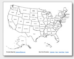
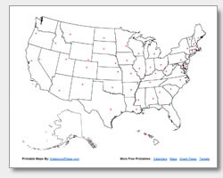
 Printable blank United States map for geography education.
Discover Various United States Map Printables
- Blank US Map Printable: This printable blank United States map is an excellent tool for quizzes, state identification exercises, or for creating your own custom map. Students can practice labeling states, rivers, or mountain ranges, making it a versatile resource for geography education.
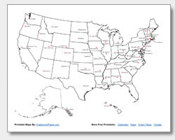
 Printable United States map with state names for easy learning.
- US Map with State Names Printable: For those learning the states, our US map with state names printable provides clear labels for each state. This map is ideal for beginners and anyone needing a quick reference guide to state locations and names.
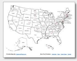 Printable US map showing states and their capital cities, ideal for study.
- US Map with State and Capital Names Printable: Take your geography knowledge further with our US map with state and capital names. This detailed map is perfect for students studying state capitals and their locations. It’s a valuable tool for test preparation and in-depth learning.
 Printable map of the United States highlighting state capitals for geographical studies.
- Printable State Capitals Map: If you’re focusing specifically on capitals, our printable state capitals map highlights just the capital cities. This map is great for quizzes focused on capitals or for quickly locating state capital cities.
 Printable location map of US state capitals for detailed geographical reference.
- State Capital Location Map Printable: For a slightly different visual approach, the state capital location map printable uses location stars to pinpoint each capital. This style can be particularly helpful for visual learners and adds a different dimension to studying capital locations.
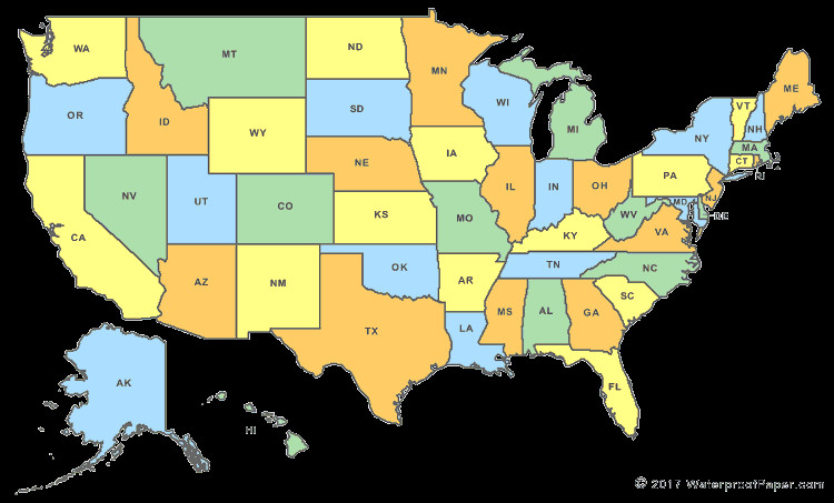 Downloadable colorful United States map for classroom use and educational displays.
Maximize Learning with a United States Map to Print
Teachers can greatly benefit from using our united states map to print in the classroom. Imagine assigning students a blank map to fill in state names and capitals as a homework assignment, or using the labeled maps for in-class discussions. The act of researching and physically writing on the map enhances memorization and geographical understanding. Encourage students to use online resources like Geology.com’s United States map as a reference tool to complete their maps.
In conclusion, having a united states map to print is a fantastic resource for education, reference, and general knowledge. Feel free to download and print as many copies as you need. Share them with your students, colleagues, and friends to spread geographical awareness and learning!